Dominican Republic Map: Best and Complete Travel Guide for Visitors
Exploring the Dominican Republic becomes much easier when you understand its geography. A good Dominican Republic map is not just a picture — it’s a tool for planning flights, choosing the right airport, deciding whether to rent a car, and even predicting where sargassum may appear. In this guide, I’ll share how I personally use Dominican Republic maps when traveling, along with practical tips that go beyond what you find on stock images or generic sites.
Why Travelers Rely on Dominican Republic Maps
When I first looked at a map of the Dominican Republic, the main goal was simple: find where Punta Cana and Santo Domingo are. These two destinations generate the most questions from travelers. People want to know if it’s worth flying into Santo Domingo instead of Punta Cana to save on airfare. In fact, I’ve done this myself — flights to Santo Domingo are often cheaper, and renting a car there to drive east to Punta Cana can be an excellent strategy.
Finding Punta Cana, Santo Domingo, and Puerto Plata
Maps make orientation easier. Punta Cana is on the far eastern tip, facing both the Caribbean and the Atlantic. Santo Domingo lies about 200 km west, along the southern coast. Puerto Plata, in contrast, sits up north on the Atlantic. Seeing them plotted on a map instantly helps travelers understand distances that otherwise feel abstract.
Understanding flight and transfer options through maps
When comparing flight prices, I always pull up a map first. It helps to visualize whether it makes sense to land in Santo Domingo, save money, and then transfer by road. Sometimes it’s not just about cost, but also time and convenience.
Using maps to plan car rentals and road trips
I’ve rented cars several times in the Dominican Republic, and road maps are essential. They help identify toll highways (autopistas), scenic routes, and realistic driving times. Without a map, it’s easy to underestimate travel time between cities.
Key Regions and Airports on the Dominican Republic Map
The Dominican Republic has multiple international airports, but three stand out. I’ve personally compared them on maps to decide which works best depending on the trip.
Punta Cana International Airport (PUJ)
Most beach travelers arrive here. PUJ is minutes from major resorts. If you’re visiting Punta Cana, Bávaro, or Cap Cana, this airport saves you hours.
Santo Domingo Airport (SDQ) and connections
This is my favorite airport for budget reasons. It’s located near the capital, and flights often cost less than those to Punta Cana. Looking at the map, you’ll see it’s about a 2-hour drive east to Punta Cana, which makes it a solid alternative if you don’t mind renting a car.
Puerto Plata and northern routes
For trips to the north coast — Sosúa, Cabarete, Playa Dorada — Puerto Plata (POP) is the logical entry point. On the map, you’ll see it’s far from Punta Cana, so mixing both regions in one trip requires careful planning.
Caribbean vs. Atlantic Coasts: What Maps Reveal About Sargassum
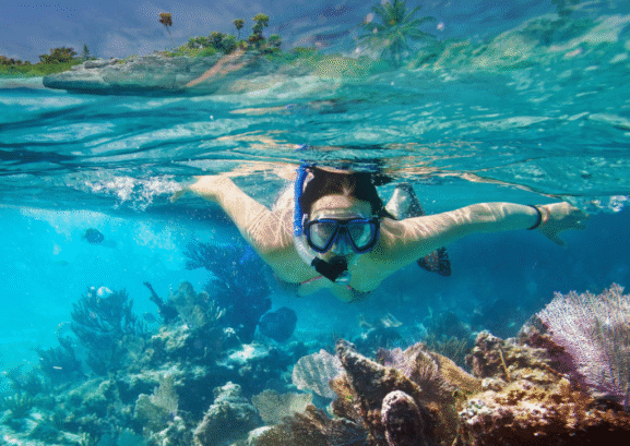
One reason I personally check maps is to understand why sargassum affects some beaches more than others. Travelers are often surprised when they see seaweed in Punta Cana, assuming it comes from the Caribbean. In reality, much of it drifts from the Atlantic side.
Why sargassum affects certain beaches more
Maps show that Punta Cana sits at the meeting point of the Atlantic Ocean and the Caribbean Sea. This position means beaches on the eastern and northern coasts may face heavier sargassum influx than the southern Caribbean-facing shores.
How to choose destinations with cleaner waters
When I planned a summer trip, I used maps to check orientation. Beaches closer to Bayahibe, for example, face the Caribbean and tend to have clearer waters when sargassum hits the Atlantic. That small detail, visible on a map, can make or break a beach holiday.
Practical Travel Distances and Driving Times
Maps are not just about airports — they’re critical for understanding road travel. I once assumed Santo Domingo to Punta Cana would take an hour. The map proved me wrong; it’s about 2–2.5 hours depending on traffic and tolls.
Road map overview: highways and toll roads
The main east–west highway, Autopista del Coral, connects Punta Cana and Santo Domingo. Maps highlight toll booths, which I always factor into driving budgets.
Travel time comparison
| Route | Approx. Driving Time | Notes |
| Santo Domingo → Punta Cana | 2–2.5 hrs | Modern highway, tolls apply |
| Santo Domingo → La Romana | 1.5 hrs | Good stop if driving east |
| Punta Cana → Puerto Plata | 6–7 hrs | Long drive, often better by domestic flight |
| Santo Domingo → Puerto Plata | 3.5–4 hrs | Scenic but slower roads |
Tips for renting a car and navigating local roads
From experience, GPS maps work well but offline maps are essential in rural areas. Road signs exist but aren’t always clear, so I recommend downloading Google Maps offline or carrying a printed map as backup.
Dominican Republic Maps for Tourists
Best free online maps and apps
Google Maps remains the most accurate for driving. For walking and biking trails, Maps.me is great offline.
Printable maps for offline use
I’ve carried simple printed tourist maps — they help when phone batteries die or signal disappears. Airports and hotels often provide free ones.
Where to find specialized tourist maps
Some tour companies hand out maps that highlight attractions, beaches, and even areas where sargassum is less common. I found these more practical than generic stock images because they’re designed for real travelers.
FAQs About Dominican Republic Maps
Where is Punta Cana on the Dominican Republic map?
On the far eastern tip, facing both the Caribbean and Atlantic.
What airport is best: Punta Cana or Santo Domingo?
Punta Cana (PUJ) is closest to the resorts, but Santo Domingo (SDQ) can be cheaper, with a 2-hour drive east.
How long does it take to drive from Santo Domingo to Punta Cana?
About 2–2.5 hours via Autopista del Coral.
Why does sargassum hit Punta Cana beaches?
Because of its Atlantic exposure; seaweed drifts from the Atlantic, not just the Caribbean.
Where can I find a reliable Dominican Republic road map?
Google Maps (offline mode), Maps.me, or printed tourist maps from hotels and airports.
Conclusion + Travel Planning Tips
Maps of the Dominican Republic are more than orientation tools. They help travelers compare flight prices, plan car rentals, and even choose beaches with less seaweed. I’ve personally saved money by flying into Santo Domingo and driving to Punta Cana — something you only realize when looking closely at a map. Whether you’re exploring airports, beaches, or highways, a good map makes Dominican travel smoother and smarter.
Want your business featured in this category? Contact: partners@puntacanahotdeals.com